
Enjoy millions of the latest Android apps, games, music, movies, TV, books, magazines & more. Anytime, anywhere, across your devices.
GPSSend is everything I would even like mountain biking, road biking or hiking on electronic support with me, together in a single app. For I will at least:
- Retrace a route,
- Track recording,
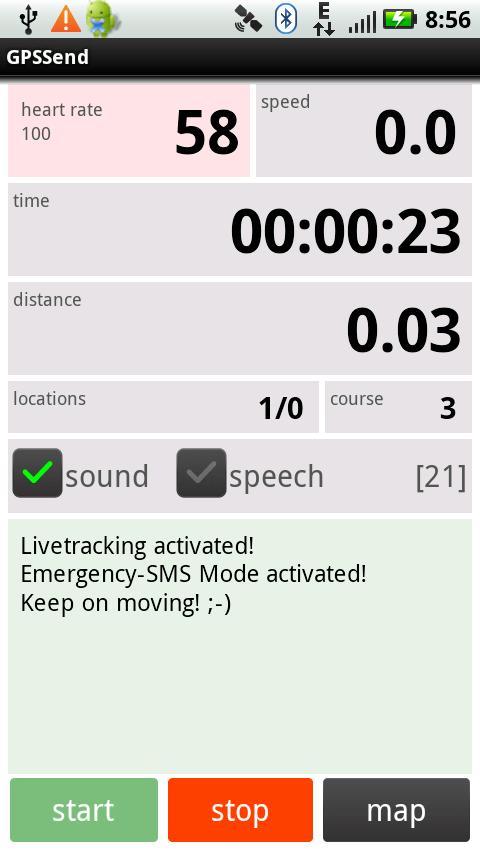
- Heart rate, speed and distance traveled to see
- An automatic accident notification via SMS,
- Download times during a tour of interesting routes,
- To allow my friends to see live where I am,
- See where my friends are straight,
- Have a map.
Features:
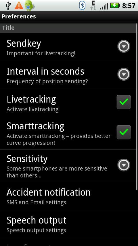
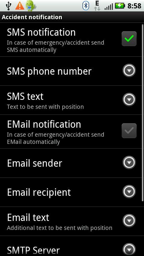
- Automatic crash notification via SMS or Email
- SMS activation of the accident report with prompt
- Live tracking of heart rate and speed
- Zephyr HxM Pulsgurtunterstützung
- Polar WearLink ® + transmitter with Bluetooth Pulsgurtunterstützung
- Integrated Online map based on Open Street Maps
- Friends and tail with arrow on the map
- Friends position in decimal degrees or UTM
- Friends motion detection with audible signal and auto-centering
- Multiple routes with different color einblendbarer
- Automatic tracking, with either GPX, KML or fitlog
- Tracking is about battery replacement or crash
- GPX format is compatible with Google Earth (Elevation Profile)
- Multilingual interface (English and German)
- Compatible QVGA (320x240 pixels)
- Also manually send the GPS position possible
- Spoken messages from observers
- Can be used in conjunction with Sport Tracks
- Integrated routing download gpsies.com
GPSSend supports not only basic outdoor orientation functions such as tracking or map page, especially with live tracking applications possible. Once you have on my server (http://biketracking.dyndns.org/geo_rbl) his friends and they have a self-selected audience (must be done only once), you can see the friends on the Map page of GPSSend. This enables applications such as:
- Meeting in the woods
- Be automatically alerted to the same friends in transit
- Friends are trying to obtain or to cut off the way :-)
- Action games such as 'fox hunting' (http://tinkerpete.wordpress.com/2012/04/09/neulich-im-wald/)
- On joint tours greater distances
Another specialty is the GPSSend automatic crash notification. It helps all the people who are alone in less frequented areas of the road and suffered an accident one (for example, if one is alone at the 'Night Biking' or a challenging trail running). This can be done in that GPSSend sent continuously at an adjustable interval position report to a server and enables it as a partner, to pursue it on a web page on a Google Map.
Even more interesting is the ability of GPSSend, in the event of an accident to automatically send an SMS or an email with the position. GPSSend continuously checks whether the user is still moving and if he - as a result of an accident - lies on the floor and not move, it can automatically send an SMS or an email.
This function can also be designed for athletes who have suffered a heart attack and after the rehabilitation is no longer trust their own sports run, be an additional security measure that helps one to begin again to be careful with sports.
Live tracking of the server:
http://biketracking.dyndns.org/geo_rbl
GPSSend on the Motorola Defy the bicycle handlebars:
http://tinkerpete.wordpress.com/2011/03/07/GPSSend-motorola-defy-bikertech-halterung/
Download maps:
http://download.mapsforge.org/maps/europe/
Convert Maps itself:
http://tinkerpete.wordpress.com/2011/02/12/wie-kann-man-openstreetmap-in-%E2%80%9Amap%E2%80%99-dateien-fur-GPSSend-konvertieren/
 Download