
All the Paths of the Valleys of Verbania at your app! Banne
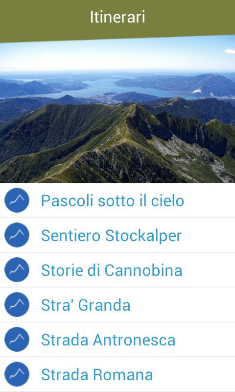
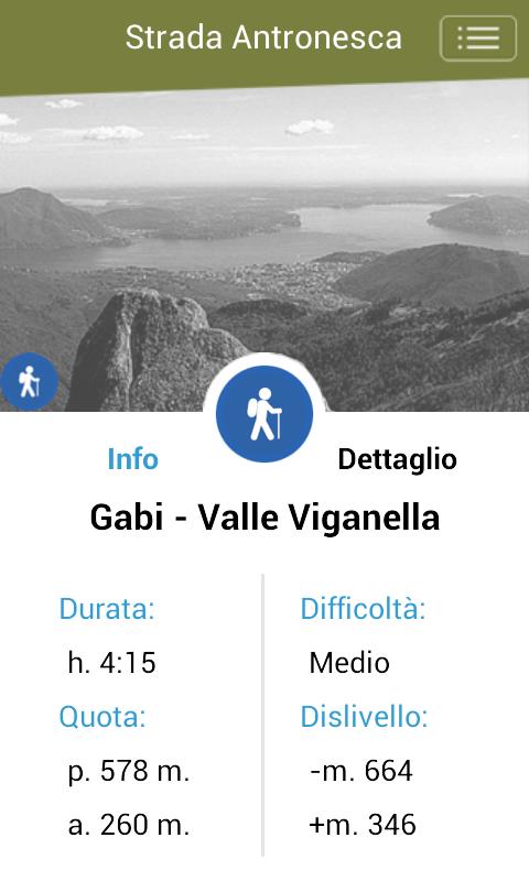
SentieriVCO is the new application that allows you to get to know all the paths of the Valleys of Verbano Cusio Ossola, from the simplest walks, to the excursions for real experts. Seven itineraries, with a hundred paths, all classified in duration, difficulty, altitude difference max and minimum, with interactive and pdf maps to download. The chosen paths fall within the Integrated Promotion Plan PSR 2007/2013, financed by the European Community.
The Beta version of SentieriVCO was designed for the tourist who is located in Verbano Cusio Ossola, in order to give information about the practicable excursions on the provincial territory. The application makes available a simple but practical tool that allows you to filter the paths on the basis of your needs, to view the maps of the paths and obtain useful information on them, and to promote the orientation during the excursions on site.
The same web portal Sentieridelverbanocusioxola.it, of which the app is an integral part, allows to identify and plan the excursions first, uniform for valley and methods of use (feet, bikes, horse). In addition, in order to improve the overall vision of the territory and the path network, an interactive cartographic map will also be available in the future.
The app currently aims to enhance seven hiking itineraries for a total of about a hundred paths. For each of the routes, a map in PDF format is already available, for download and offline use. For the routes included in the itinerary "between Lake Maggiore and Lago d'Orta" it is also possible to view the paths of the paths online and your position in real time, thanks to the GPS system of your smartphone. This functionality will also be implemented for the other paths, as soon as all GPX files are available in the province.
In the next expected releases, the contents will be enriched with new tracks, maps and information.
With the hope of having, at least in part, responded to the criticisms raised in the first comments of users, it is understood that any suggestion is always welcome and the subject of attention, for the purpose of possible improvements in the application.
 Download